• MAIN
  • MONITORING
  • MAPPING
    • Home
    • About
      • About Us
      • Our Team
      • News & Projects
      • Newsletters
      • Guides & Insights
      • Events
      • Case Studies
      • Careers
      • Contact Us
      • Sustainability & Environment
    • Industries
      • Ports & Harbours
      • Maritime Pilotage
      • Bridges & Inland Waterways
      • Energy Providers
      • Governments & Agencies
      • Case Studies
    • Compliance
      • Compliance Overview
      • Marine Data Management
      • Asset Management System
      • Spatial Data Management & GIS
      • Our Courses
    • Training
      • Our Courses
      • Data Management
      • Data Management for Ports
      • Data Management, Governance and MEDIN toolset
      • Data Management and Marine Spatial Data Infrastructure (SDI)
      • Technical Training
    • Partners
      • Licenced Partners
      • Partner’s Resource Hub
    • Support
      • Resources
      • Support
      • Contact Us
" alt="banner">

What can a tide gauge tell us about climate, navigation, and coastal resilience?

20 July 2026

What can a tide gauge tell us about climate, navigation, and coastal resilience?

OceanWise Global > News & Projects > Uncategorised > What can a tide gauge tell us about climate, navigation, and coastal resilience?

What can a tide gauge tell us about climate, navigation, and coastal resilience?

Quite a lot, as it turns out.

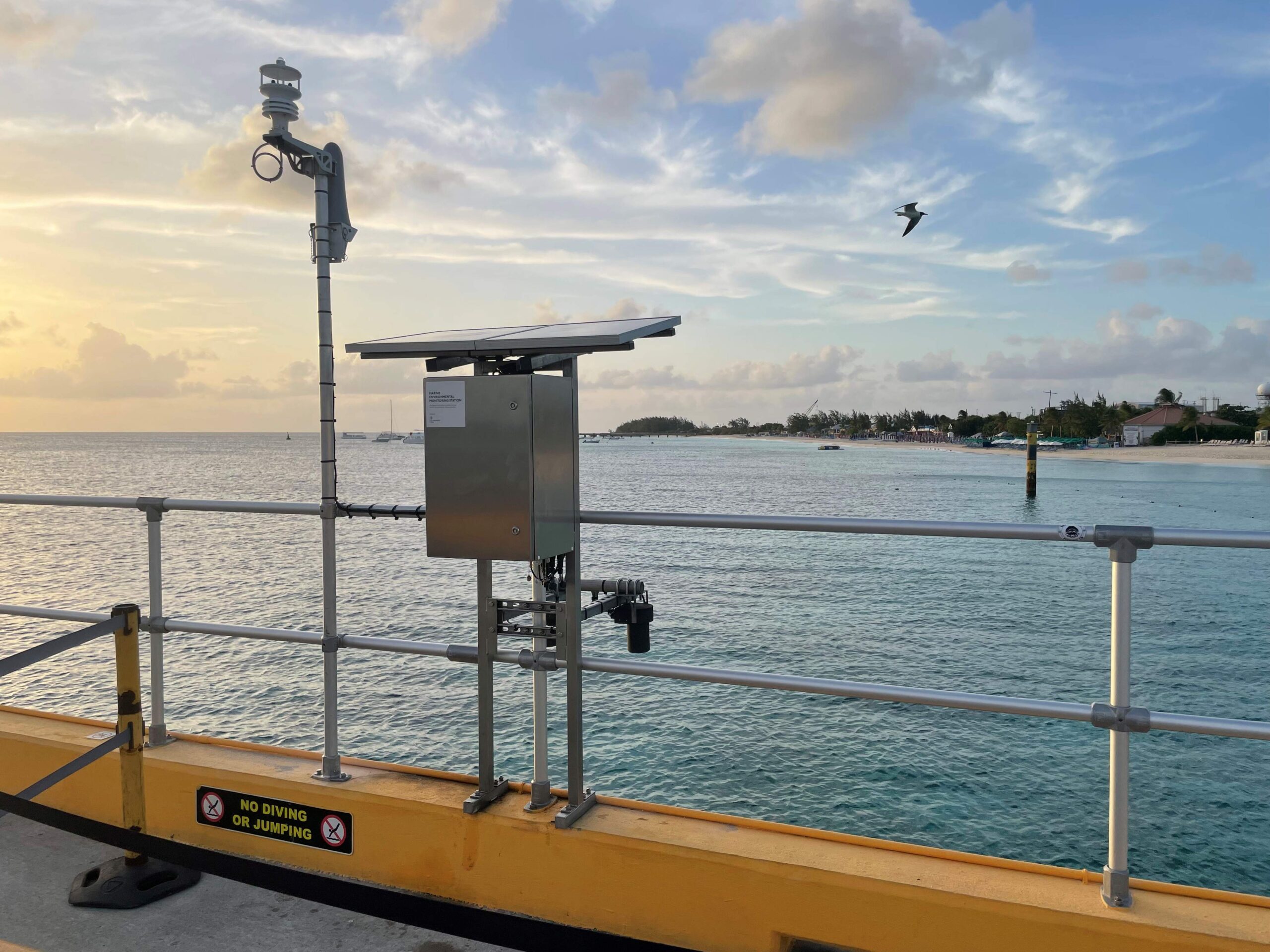
Recently, our team has been working in Grand Turk as part of our Marine Environmental Monitoring work under our framework agreement with the UK Hydrographic Office.

While installing and maintaining monitoring systems is a technical challenge in itself, the bigger takeaway is the value of the data these systems provide long after the equipment is in place.

Accurate, long-term marine observations help to:

  • Improve navigational safety for maritime users
  • Enhance our understanding of sea level change and wider environmental trends
  • Support the development and updating of nautical charts and publications
  • Contribute to tsunami warning capabilities and situational awareness
  • Provide valuable data to local communities and international initiatives monitoring sea level change around the world

Projects like this are a reminder that reliable environmental data underpins many of the decisions we make at sea, from day-to-day navigation through to long-term planning and climate resilience.

One thing we’ve learned over the years is that the true value of monitoring programmes isn’t just in the equipment itself. It’s in the quality, consistency and accessibility of the data they generate, often benefiting users far beyond the original project scope.

Connect With Us

Services

  • Environmental Monitoring
  • Port-Log Data Platform
  • Marine Mapping
  • Spatial Data & GIS
  • Training Courses
  • Compliance
  • Asset Management System

Company

  • News & Projects
  • Newsletters
  • Events
  • About Us
  • Partners
  • Our Team
  • Sustainability and the Environment
  • Careers

Resources

  • Contact Us
  • Brochures, Data Sheets and Guides
  • Monitoring Support
  • Mapping Support
  • Case Studies

© 2026 OceanWise. All rights reserved.

Privacy Policy | Terms of Service | Cookie Policy

© OceanWise 2024. OceanWise Limited is an independent company specialising in marine environmental data acquisition, management, publishing and GIS.
Registrar of Companies of England and Wales No. 7206926 and Companies Registration Office Ireland No. 641571.

Terms & Conditions | Privacy Notice | Contact Us

OceanWise HelpBot

Still need help?
This site uses cookies: Find out more.